No products
 View larger
Garmin BlueChart g3 HD - HXEU062R - Russian Inland Waterways - microSD /SD
40074
40074
New product
More info
BlueChart® g3 HD - HXEU062R - Russian Inland Waterways - microSD™/SD™
Coverage:
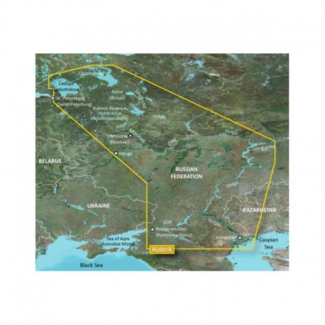
This Cyrillic data card details main channel coverage of the major river systems and lakes of western Russia. Detailed coverage includes the Don R. from the Sea of Azov (Azovskoe More) to the Tsimlyanskoe Reservoir (Tsimlyansk Vodokhranilishche); the Volga-Don Canal (Volgo-Donskoy Kanal) to the Volga R. which is shown in its entirety; the Kama R. from Tyul'kino to the Volga R.; the Vishera R. from Ryabinino to the junction with the Kama R.; the Oka R. from Kaluga to its junction with the Moskva R; the Sheksna R. in its entirety; Lake Beloe (Beloye Ozero); the Volga-Baltic Canal (Volgo-Baltiyskiy Kanal); Lake Onega (Onezhskoe Ozero); the Svir R. to Lake Ladoga (Ladozhskoye Ozero); and the Neva R. to St. Petersburg (Sankt-Peterburg). Also included are the Volga-Baltic Waterway including the Rybinsk Reservoir (Rybinskoye Vodokhranilishche), the entire White Sea-Baltic Canal, and Lakes Onega (Onezhskoe), Ladoga (Ladozhskoye), and Beloe (Beloye).
Unparalleled Coastal Chart Coverage
- Provides industry-leading coverage, clarity and detail with updated coastal charts that feature integrated Garmin and Navionics® data
- Auto Guidance¹ technology calculates a route using your desired depth and overhead clearance and provides a suggested path to follow
- Includes Depth Range Shading for up to 10 depth ranges, enabling you to view your target depth at a glance
- Up to 1


