Cart
0
Product
Products
(empty)
No products
To be determined
Shipping
$0.00
Total
Product successfully added to your shopping cart
Quantity
Total
There are 0 items in your cart.
There is 1 item in your cart.
Total products
Total shipping
To be determined
Total
 View larger
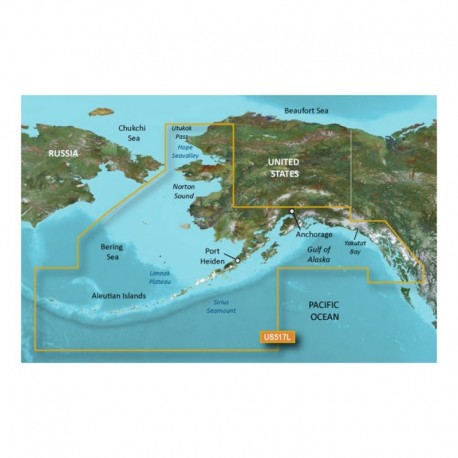
Garmin BlueChart g3 Vision HD - VUS517L - Alaska South - microSD /SD
31928
31928
New product
Garmin BlueChart g3 Vision HD - VUS517L - Alaska South - microSD /SD
More info
BlueChart® g3 Vision® HD - VUS517L - Alaska South - microSD™/SD™
Coverage:
Alaska, from Prince of Wales Island to Point Lay on the North Slope, including Glacier Bay, the Kenai Peninsula, and the Aleutian Chain in full. Bathymetric coverage of the Gulf of Alaska, Bristol Bay and United States waters in the Chukchi and Bering Seas, and along the entire Aleutian chain including the Surveyor Seachannel, Aleutian Trench, Umnak Plateau, Chirikof Basin, and Hope Seavalley.
Premier Coastal Navigation Charts
- Provides industry-leading coverage, clarity and detail with updated coastal charts that feature integrated Garmin and Navionics® data
- Auto Guidance¹ technology uses your desired depth and overhead clearance to calculate routes and show a suggested path to follow
- High-resolution relief shading combines color and shadow to give you an easy-to-interpret, clearer view of bottom structure than contour lines alone
- Depth Range Shading provides up to 10 depth ranges, enabling you to view your target depth at a glance
- Up to 1


